
Free construction calculators for quick, accurate estimates, measurements, and project planning
How Much Does a Property Survey Actually Cost in the USA?
A property survey in the United States typically costs somewhere between $200 and $1,200 for a standard residential job, though the final number depends heavily on property size, location, survey type, terrain, and how much research the surveyor has to do before ever setting foot on the property. There’s no single fixed price for a property survey, since two properties of similar size can require very different amounts of work.
Here’s what actually drives property survey cost, how pricing differs by survey type, and what you can do to get a more accurate estimate for your own property before contacting a surveyor.
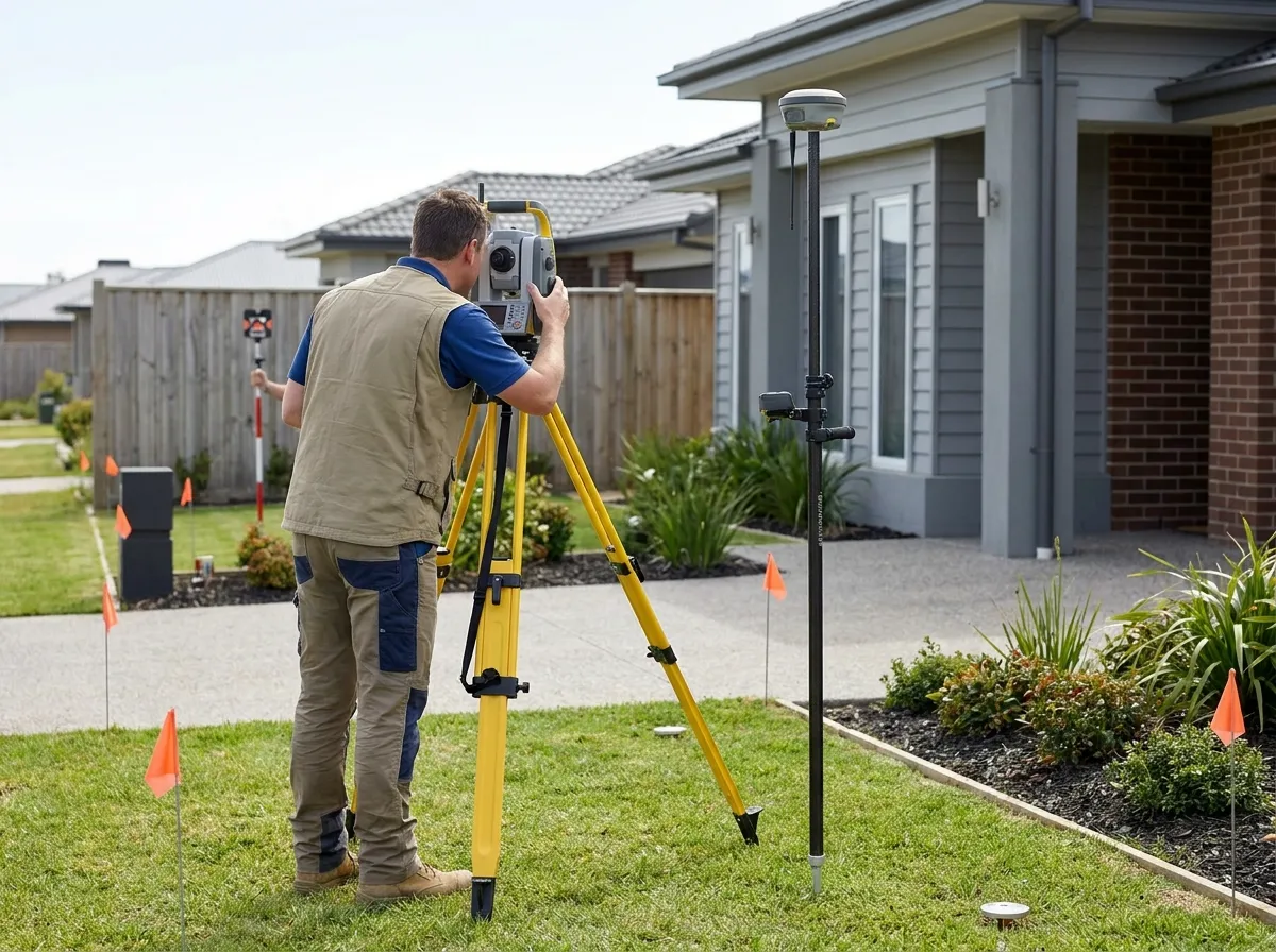
Property survey prices vary widely because a survey isn’t a single, standardized service. A simple boundary check on a small, well-documented residential lot might cost a few hundred dollars, while a detailed survey on a large or complex property can run into the thousands.
People ask this in plenty of different ways: how much do property surveys cost, how much for a property survey, or how much should a property survey cost, and the honest answer to all of them is the same: it depends on the specifics of the property.
As a general reference point, homeowners often see the following typical ranges for common survey types:
- Basic boundary survey on a standard residential lot: roughly $200 to $800
- Full residential property survey with a detailed plat: roughly $500 to $1,500
- Larger, more complex, or commercial-grade surveys (including ALTA/NSPS surveys): roughly $1,000 to $5,000 or more
These are general, illustrative ranges rather than fixed prices. The average cost of property survey work, sometimes called the typical survey cost, depends on local market rates, so a quote from a licensed surveyor is the only way to know the actual cost for your specific lot.
Construction Maths offers a set of free calculators designed to help property owners get a general sense of costs before reaching out to a professional. You can find them, along with other measurement and cost tools.
What Is Included in the Cost of a Property Survey?
A property survey quote covers more than the time a surveyor spends walking your property with equipment. Most of the property survey cost, or cost of surveyor services more broadly, goes toward a combination of fieldwork and behind-the-scenes preparation.
- Property research: reviewing deeds, plats, and public land records before fieldwork begins
- Field measurements: locating and measuring boundary points, structures, and physical features
- Locating property boundaries: identifying or re-establishing corner markers and boundary lines
- Mapping and drafting: turning field data into a finished survey drawing or plat
- Equipment and travel: the cost of specialized surveying tools and time spent getting to and from the site
- Professional expertise: the surveyor’s license, liability, and legal responsibility for the accuracy of the final document
Surveying cost reflects both the physical work on-site and the research and documentation that happens before and after the visit. A property that requires more record-searching or a more detailed final document will typically cost more, even if the fieldwork itself takes a similar amount of time.
What Factors Affect Property Survey Cost in the USA?
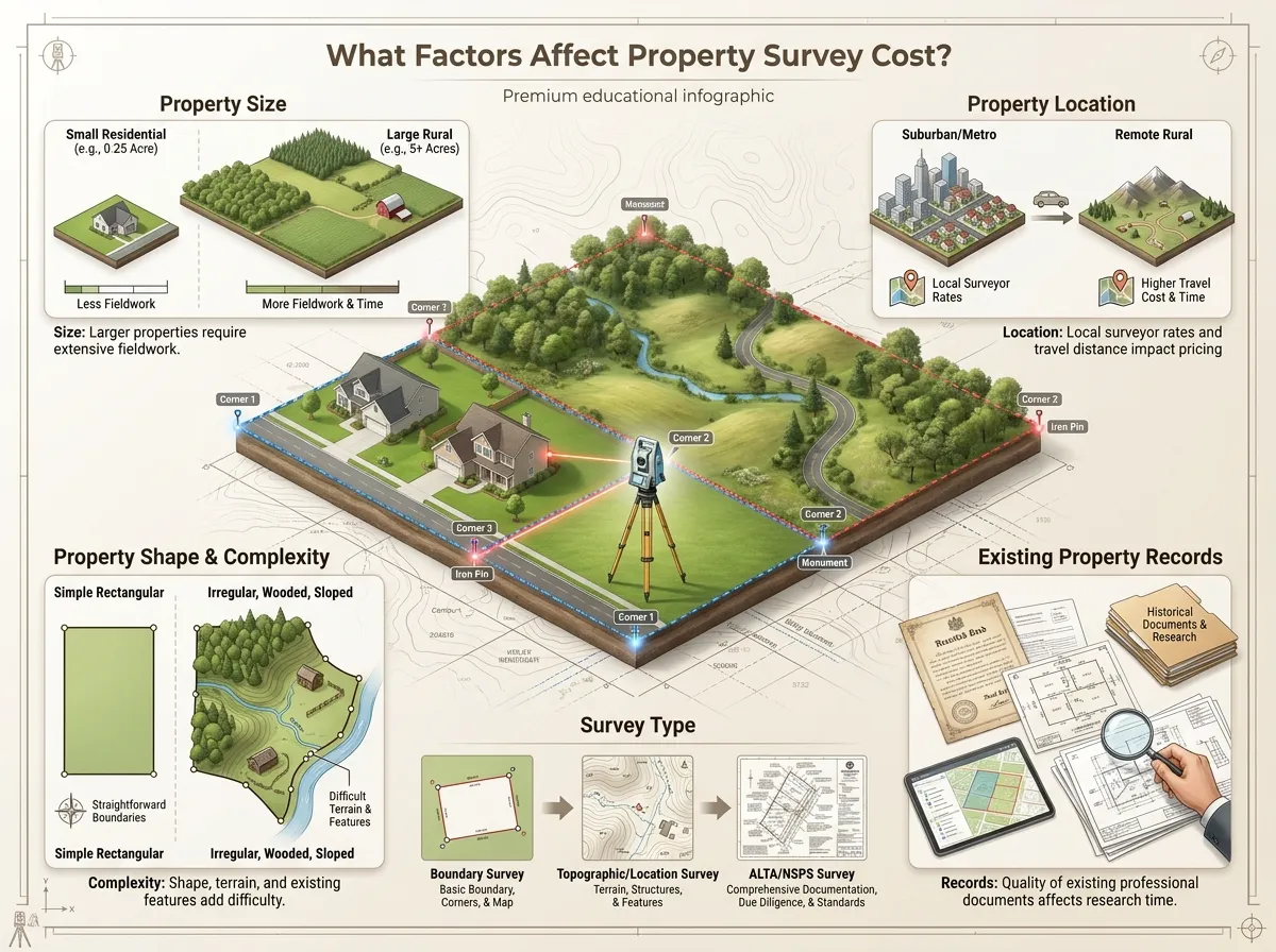
Several variables combine to determine the final price of any given survey. Understanding them helps explain why two seemingly similar properties can receive very different quotes.
1. Property Size
Larger properties generally require more time in the field, since there’s more boundary line to measure and more area to document. A quarter-acre suburban lot takes far less time to survey than a ten-acre rural parcel, even with similar terrain.
2. Property Location
Where a property is located affects surveying cost in two ways. Local market rates for licensed surveyors vary from region to region across the U.S., often significantly between a dense metro area and a rural county, and properties farther from a surveyor’s office may involve additional travel time and expense.
- Local surveyor rates differ by state, county, and even city
- Metro areas often have more surveyors competing for work, which can affect pricing
- Rural or remote properties may add travel time and cost to the quote
3. Property Shape and Complexity
Irregular boundaries, wooded areas, steep terrain, and properties with multiple existing structures all tend to increase the amount of fieldwork required. A property with unclear or previously disputed boundaries can also take significantly longer to resolve than one with straightforward, well-marked lines.
4. Existing Property Records
Available deeds, prior surveys, and public records make a surveyor’s research phase faster and more reliable. When records are missing, outdated, or inconsistent, the surveyor has to spend more time reconstructing the property’s history, which adds to the overall cost.
- Prior boundary or ALTA surveys already on file
- Recorded deeds and legal descriptions
- Subdivision plats filed with the county
- Public GIS or county assessor records
- Recorded easements or right-of-way documents
5. Survey Type
Different types of surveys involve different levels of detail, accuracy, and documentation, so average cost for property survey work varies significantly by type. A basic boundary check and a full ALTA/NSPS land title survey are not comparable in scope, and their pricing reflects that difference, a topic covered in more detail in the next section.
Property Survey Cost by Survey Type
The term “property survey” actually covers several distinct services, each with its own typical cost range. Knowing which type you need is often the biggest factor in getting an accurate quote.
| Survey Type | What It Is | Typical Use | Why Cost Varies |
|---|---|---|---|
| Boundary survey | Establishes the legal boundary lines of a property | Confirming property lines before building or disputes | Boundary clarity, terrain, and record availability |
| Property line survey | A focused version of a boundary survey, often for one or two lines | Fence installation, neighbor disputes, additions near a line | Number of lines surveyed and marker condition |
| Residential land survey | A general survey of a home lot, often including a plat | Home purchase, refinancing, permitting | Lot size, shape, and existing documentation |
| Topographic survey | Maps elevation changes and physical features of the land | Site planning, drainage design, construction planning | Terrain complexity and level of detail required |
| ALTA/NSPS survey | A highly detailed survey meeting national title standards | Commercial transactions, title insurance requirements | Extensive research, documentation, and certification |
| Construction survey | Marks locations for building elements during construction | Staking out foundations, utilities, or grading | Number of features staked and site conditions |
| Plot survey | A simplified survey showing lot boundaries and structures | Permitting, small additions, general reference | Similar to a basic boundary survey, usually smaller scope |
Cost of property line survey work tends to sit toward the lower end of the range, since it usually covers less ground than a full boundary or residential land survey. Plot survey cost tracks closely with basic boundary survey pricing, since the two often involve a similar scope of work.
Real estate survey cost for a full residential transaction often falls in the middle of the range, while an ALTA/NSPS survey commands a higher price because of the additional certification and documentation it requires.
How Much Does a Residential Property Survey Cost?
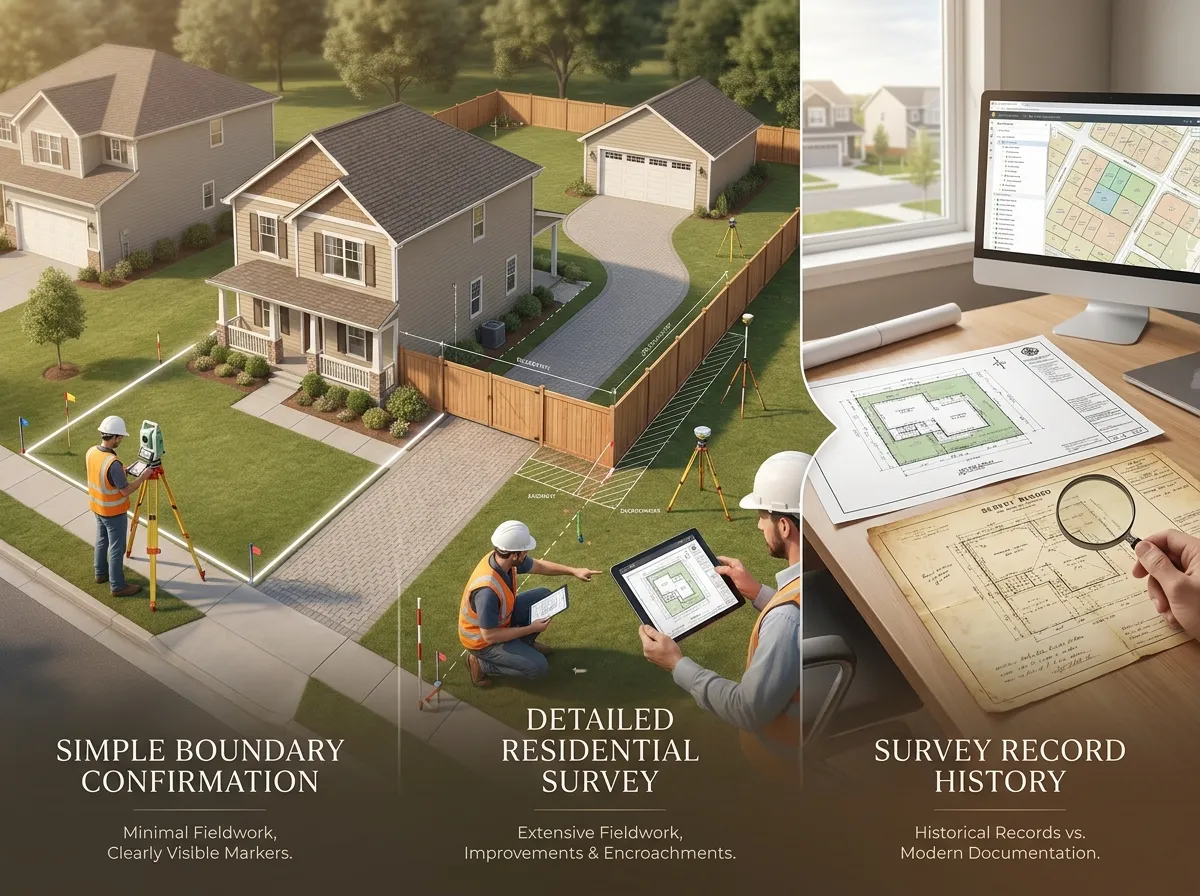
Residential survey cost depends heavily on in case you need a simple confirmation of existing boundaries or a more detailed survey with a full plat and improvement locations. This is really what people mean when they ask how much does a residential survey cost or how much does a residential land survey cost: the answer changes based on how much detail the situation actually calls for.
A straightforward residential property survey on a typical suburban lot, with reasonably clear existing records, tends to sit toward the lower end of the general price range described earlier.
More detailed residential land survey work, including locating structures, easements, and any encroachments, takes longer and costs more. This is common when a lender or title company requires a more thorough document as part of a home purchase, rather than a simple boundary confirmation for a homeowner’s own reference.
The cost to survey residential property also depends on how recently the lot was last surveyed. A property with a clear, recent survey on file is usually faster and cheaper to re-confirm than one that hasn’t been surveyed in decades.
How Much Does It Cost to Get a Property Surveyed?
For a homeowner arranging a survey for the first time, the cost to get a property surveyed depends on being clear about what you actually need before requesting quotes. Surveyors typically ask a few questions upfront: the reason for the survey, the property’s approximate size, and if any existing documentation is available.
Once a surveyor has that information, they can usually give a reasonably firm quote before starting work. The cost to have a property surveyed can shift if additional issues come up once fieldwork begins, such as missing boundary markers or a discrepancy with a neighboring property’s records, so it’s worth asking upfront how a surveyor handles unexpected complications.
Most residential jobs are quoted as a flat fee once the scope is clear, rather than an hourly rate, which makes it easier to compare quotes between different surveyors for the same property.
You’ll see this same question worded a few different ways: how much does it cost to get property surveyed, how much to get property surveyed, how much to have property surveyed, how much does it cost to have your property surveyed, how much does it cost to survey property, or how much does it cost to get your property surveyed. Whatever the exact wording, the answer comes down to the same factors covered throughout this guide.
How Much Does a Land Survey Cost?
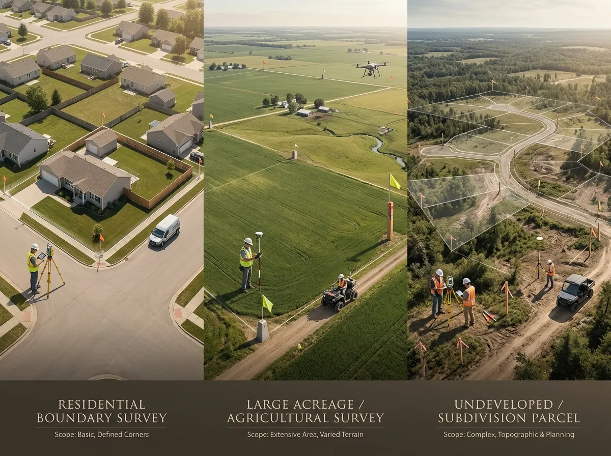
“Land survey” is a broader term than “property survey,” and it can refer to several different types of surveying work depending on what needs to be established. This is one reason the cost of a land survey varies so widely between different jobs and different regions.
A basic land survey confirming residential boundaries falls into the same general range discussed earlier in this guide. A larger land survey covering acreage, agricultural land, or a property intended for subdivision typically costs more, since it involves more area, more research, and often more complex documentation.
How much a land survey costs comes down to the same core factors as any property survey: size, location, complexity, and the type of documentation required. Some property owners search for this specifically as how much it is to get land surveyed, how much it costs to have your land surveyed, or how much it costs to get a land survey, and the answer follows the same logic either way.
If you’re specifically researching land survey cost for a large or undeveloped parcel, expect pricing closer to the higher end of typical ranges rather than the lower end seen on small residential lots.
How Much Does a Property Line Survey Cost?
A property line survey, sometimes called a boundary survey, focuses specifically on confirming where one property ends and another begins. People typically need one in a handful of common situations.
- Buying or selling property, to confirm the exact boundaries before closing
- Building a fence, to avoid encroaching on a neighbor’s land
- Resolving a dispute with a neighbor over where a boundary actually sits
- Planning construction near a property line, where setback requirements apply
- Simply confirming boundary locations before starting a landscaping or improvement project
Property boundary survey cost for a simple, well-documented line is usually on the lower end of the overall pricing range. Cost of property line survey work increases when boundary markers are missing, when there’s a discrepancy between neighboring surveys, or when the line in question hasn’t been clearly established in decades.
How Surveyors Determine the Cost of a Property Survey
Surveyors typically build a quote around a handful of core variables rather than a flat, one-size-fits-all rate. When someone asks how much to survey property, they’re usually really asking how a surveyor arrives at that number in the first place, and understanding this process helps explain why two properties can receive noticeably different prices.
The scope of work comes first: what exactly is being surveyed, and for what purpose. From there, property size, survey type, and the amount of research required all factor into the estimated time. Fieldwork conditions, including travel distance, terrain, and boundary complexity, get added on top, along with the format and detail level of the final deliverable.
Local pricing norms also play a role, since surveyor rates in a dense urban market can differ meaningfully from rates in a rural area with less competition and lower overhead. Two surveyors quoting the same property may still land on somewhat different numbers depending on how they weigh these factors.
How to Estimate Your Property Survey Cost
Before contacting a surveyor, it can help to get a general sense of what your project might cost based on property size and survey type. Use our Land Survey Cost Calculator to estimate your potential survey cost based on the details of your property.
An online estimate like this is meant as a starting reference point, not an official or legally binding quote. Actual professional survey fees depend on factors a calculator can’t fully account for, like specific boundary conditions, local surveyor availability, and the exact scope a licensed professional determines is necessary once they review your property.
What Can Increase the Cost of a Property Survey?
Certain conditions consistently push property survey pricing toward the higher end of the typical range. Knowing these ahead of time can help you set realistic expectations before requesting quotes.
- Large properties with extensive boundary lines to measure
- Difficult terrain, steep slopes, or dense vegetation
- Wooded or otherwise hard-to-access areas
- Unclear or previously disputed boundaries
- Missing or incomplete property records
- Old records that no longer match current conditions on the ground
- Boundary markers that are damaged, buried, or difficult to locate
- Additional research needed to resolve conflicting documentation
- Urgent turnaround requests that require rescheduling other work
- Extra survey requirements beyond a standard boundary confirmation
- Specialized survey types, such as ALTA/NSPS or detailed topographic work
How to Get an Accurate Property Survey Cost Estimate
Getting a reliable quote comes down to giving a surveyor clear, complete information upfront rather than a vague description of the property.
- Determine why the survey is needed (sale, dispute, construction, permitting).
- Identify the property’s approximate size and general location.
- Determine which survey type actually fits your situation.
- Gather any existing property documents, deeds, or prior surveys.
- Ask for a detailed quote that specifies exactly what’s included.
- Compare quotes carefully, since scope can vary even at similar price points.
- Use an online estimate as an initial reference point before requesting formal quotes.
Property Survey Cost: Example Estimate
The following is a hypothetical example only, meant to illustrate how the factors above combine into a final price. It does not represent an actual industry average or a real quote.
Example: A homeowner needs a boundary survey for a half-acre suburban lot to confirm property lines before installing a new fence. The lot has a prior survey on file from about ten years ago, and access is straightforward with no wooded or difficult terrain.
Given the existing records, small lot size, and easy access, this project would likely fall toward the lower to middle portion of the typical boundary survey range discussed earlier in this guide, rather than the higher end reserved for large, complex, or poorly documented properties. A property with wooded terrain, no prior survey, or a boundary dispute would push the same job toward a higher estimate.